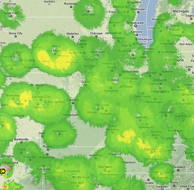
The radar image of the midwest provided by Weatherunderground at 10:30 PM Central time, May 8 2011 has odd patterns.
Are these patterns real? Perhaps caused by large scale convection over cities? Or are they artifacts of radar placement?
Here is the image that I am referring to, where green indicates light and yellow moderate rain:

